
The hiking map made exploring the area easier and inspired visitors to discover more
CASE: Design and production of a hiking map for tourism businesses
In this project, we designed and produced a hiking map that brings together the region’s attractions and activities in one clear overview. The map makes it easier for visitors to navigate the area, encourages them to explore local trails and destinations, and helps extend the length of their stay.
Initial situation
The Korpijärvi region in Southern Savonia offers a wide range of outdoor destinations, but many of them were largely unknown to visitors.
Tourist stays often remained short because guests struggled to find activities and places to explore. At the same time, staff at local tourism businesses were constantly asked for recommendations about nearby attractions, yet it was impossible to go through all the options with every customer.
A tourism company operating in the area wanted to improve the situation both for its own customers and for the benefit of other local businesses.
Project goal
The aim of the project was to make local hiking destinations easier to discover and more appealing, while providing visitors with a clear and accessible overview that would help them plan activities independently.
Another key objective was to reduce the amount of time spent on customer guidance and recommendations.
What was done
The project was carried out as part of a business consortium initiative supported by the European Agricultural Fund for Rural Development under the Rural Development Programme for Mainland Finland 2014–2020.
We designed and produced a double-sided A1 hiking map that serves both as a trip-planning tool and as a practical guide for exploring the area on site.
The map was built using OpenStreetMap data, enabling a cost-effective implementation.
The design process focused particularly on usability and clarity. Around 40 hiking destinations and attractions were included on the map, with short introduction texts written for the key locations. More detailed maps were created for the most popular routes. The visual style was kept clean, simple, and easy to read.
RESULTS 


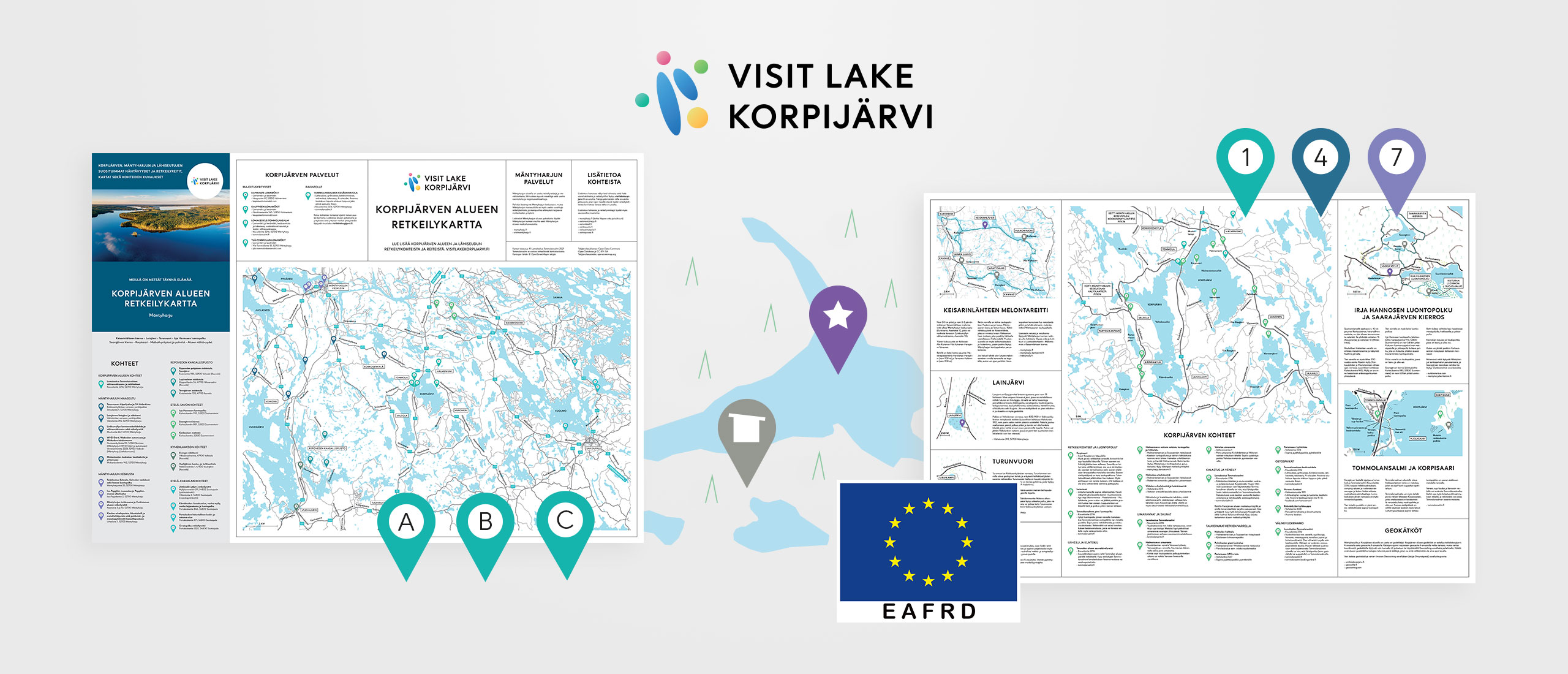
- Exploring local hiking destinations became easier and more appealing for visitors.
- Visitors discovered new places and were able to plan activities independently.
- The average length of stay in the area increased.
- The amount of time spent on customer guidance and recommendations decreased.
- The map became a practical and easy-to-use tool for both visitors and tourism businesses.
- Visitors gained a clear understanding of the destinations and could more easily choose activities that suited their interests and skill levels.
PROJECT LESSON 


A good hiking map is more than just a navigation tool — it helps visitors make decisions and inspires them to get out and explore.
PROJECT INFORMATION 


Client: a Finnish SME operating in the tourism industry
Client relationship duration: over 15 years
Project scope: design and production of a hiking map
Project scale: an extensive mapping, planning, and implementation project
Client responsibilities: concept development and identification of hiking destinations
My responsibilities: concept development, mapping of hiking destinations, visual design, content planning, map production (including image sourcing, image editing, illustration work, copywriting, and layout design), as well as project documentation for funding authorities